NeoTech vs. Google Earth and Google Street View: The Future of 3D Mapping
NEOTECH. In a world where 3D mapping technologies are integral to urban planning, navigation, and even virtual experiences, two major platforms stand out: Google Earth and Google Street View. These tools have long been popular for exploring our physical environment, allowing users to interact with satellite imagery and street-level visuals. However, NeoTech is emerging as a future-forward alternative, taking the capabilities of 3D mapping to new heights through its innovative approach.
Let’s dive into a detailed comparison between Google Earth, Google Street View, and NeoTech, and explore why NeoTech could shape the future of 3D mapping.
Google Earth: A Global View from Above
Google Earth revolutionized how we view the planet, giving users satellite-based, interactive maps with 3D imagery of terrains and landmarks. It offers a global perspective, allowing individuals and organizations to explore any region with aerial and topographic details. Google Earth’s primary use cases include:
- Education
: Teachers and students explore the world’s geography interactively.
- Urban Planning
: Engineers use Google Earth for preliminary visualizations of cities and natural landscapes.
- Travel & Tourism
: Users can explore famous landmarks and cities, often inspiring travel.
However, Google Earth has its limitations. It provides a generalized, low-resolution view of the Earth’s surface. While it offers impressive aerial visuals, the data isn’t granular enough for precise measurements or detailed urban modeling. For tasks requiring high precision—such as smart city planning, infrastructure projects, or metaverse applications—Google Earth falls short.
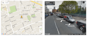
Google Street View: A Street-Level Exploration Tool
Google Street View offers an immersive experience by enabling users to navigate streets at a ground level. Captured through camera-equipped vehicles, this service provides panoramic imagery, allowing users to virtually “walk” through cities, neighborhoods, and even remote areas. It’s widely used for:
- Navigation
: Getting a feel for an area before visiting it in person.
- Real Estate
: Prospective buyers can explore neighborhoods without leaving their homes.
- Business Listings
: Storefront views help users find local businesses.
Despite these use cases, Google Street View is limited in terms of accuracy and depth. It doesn’t allow users to interact with precise measurements, detailed 3D models, or data integration needed for tasks like engineering and city infrastructure development. The visuals are useful for exploration, but they lack the precision and versatility required for more advanced applications like point-cloud generation or AI-driven urban planning.
NeoTech: The Future of 3D Mapping
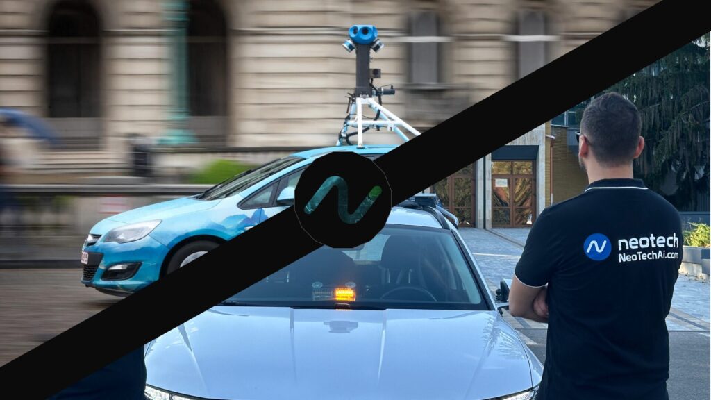
NeoTech offers a next-generation solution that surpasses the capabilities of both Google Earth and Google Street View. By integrating high-precision 3D scanning, point-cloud technology, and AI, NeoTech delivers an unparalleled level of accuracy, usability, and scalability for urban development, metaverse applications, and beyond.
Here’s how NeoTech stands out:
- Sub-3cm Precision: NeoTech’s 3D mapping technology achieves an unprecedented level of accuracy, down to sub-3cm, making it ideal for city planners, engineers, and geodetic experts.
- Dynamic Point-Cloud Models: Unlike Google Earth or Street View, NeoTech doesn’t just offer visuals. It generates dynamic 3D point-cloud models of entire cities, streets, and even individual buildings. These models allow users to measure distances, dimensions, and areas with pinpoint precision—a critical feature for large-scale infrastructure projects and smart city applications.
- Smart City Integration: NeoTech goes beyond visual representation. It integrates its 3D models into smart city platforms, allowing public administrations to monitor and manage urban environments in real-time. Governments and city planners can use this data for optimizing traffic, improving infrastructure, and even predictive maintenance for utilities.
- AI-Enhanced Processing: NeoTech uses AI-driven algorithms to process massive datasets from its vehicle-mounted scanners, drones, and high-resolution cameras. This allows for faster, more accurate data analysis, transforming raw data into actionable insights for both public and private sectors.
Use Cases for NeoTech’s 3D Mapping Technology
For Public Administrations: NeoTech provides tools that give city planners access to precise, up-to-date data. Urban areas can be modeled in real-time, facilitating everything from roadwork to new construction, improving decision-making and allowing cities to optimize infrastructure. NeoTech’s high-resolution scans help cities stay ahead of urban growth and development challenges.
For Geodetic Engineers: Geodetic engineers can benefit significantly from NeoTech’s point-cloud technology. Instead of relying on outdated methods of surveying, engineers can instantly obtain accurate, 3D models of cities and landscapes. This improves the precision of large-scale projects, saving time, reducing costs, and minimizing errors.
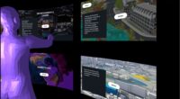
For the Metaverse: NeoTech’s dynamic 3D models are not just practical but also immersive, making them ideal for use in virtual environments. By offering AI-powered 3D twins of real-world locations, NeoTech is setting the stage for metaverse experiences that feel truly lifelike, enabling seamless integration between the physical and digital worlds.
Why NeoTech is the Future of 3D Mapping
As cities become smarter, and industries become more reliant on accurate, real-time data, the demand for precision in 3D mapping will continue to grow. NeoTech is perfectly positioned to lead this transformation with its high-precision point clouds, AI integration, and blockchain-enhanced security.
Unlike Google Earth and Street View, which focus on broad usability and general exploration, NeoTech offers the scalability, precision, and usability that modern industries and public administrations require. From city planning and smart infrastructure to immersive metaverse experiences, NeoTech represents the future of 3D mapping.

For more information on how NeoTech can revolutionize your city or project, visit our website and explore our cutting-edge solutions in 3D mapping and digital twin technologies.